

Files
Download Full Text (252 KB)
Document Type
Specimen
Publication Date
6-27-2012
Creative Commons License

This work is licensed under a Creative Commons Attribution-Noncommercial-Share Alike 3.0 License.
Occurrence ID (GUID)
0b92a22c-4301-4c92-af6c-f2e4adb941ab
Barcode Number
EIU079117
Other ID Number
43171
Kingdom
Plantae
Phylum
Magnoliophyta
Order
Ericales
Family
Primulaceae
Genus
Samolus
Specific Epithet
parviflorus
Recorded By
Phillippe, Loy R.
Record Number
43171
Event Date
2012-06-27
Attributes
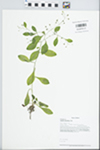
White flowered herb growing in small seepage area about 4 feet above the main channel of Rock Creek.
Associated Taxa
Celtis occidentalis, Juniperus virginiana, Ostrya virginiana, Quercus rubra, Lonicera, Cystopteris bulbifera, Asimina triloba
Reproductive Condition
Flowering
Country
USA
State/Province
Illinois
County
Kankakee
Locality
Illinois: Kankakee County. 41.21367 Latitude -87.98695 Longitude Quadrangle: Bourbonnais. Kankakee River Watershed. Kankakee River State Park. West side of Rock Creek in the canyon just above the main channel of Rock Creek and about 0.65 mile north of State Route 102. Grand Prairie Section of the Grand Prairie Natural Division. Coordinate Datum: WGS84/NAD83. West Bank of Rock Creek very near the main channel.
Decimal Latitude
41.21367
Decimal Longitude
-87.98695
Datum
WGS84
Verbatim Coordinates
41.21367° Latitude -87.98695° Longitude
Min. Elevation in Meters
177
Verbatim Elevation
580 feet

