

Files
Download Full Text (278 KB)
Document Type
Specimen
Publication Date
6-1-2012
Occurrence ID (GUID)
be736025-78b6-4608-af90-ca019c03b63a
Barcode Number
EIU079147
Kingdom
Plantae
Phylum
Magnoliophyta
Order
Rosales
Family
Moraceae
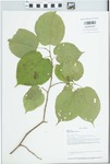
Genus
Morus
Specific Epithet
rubra
Recorded By
Phillippe, Loy R.
Record Number
43160
Event Date
2012-06-01
Remarks
Edge of woods with Acer saccharum, Celtis occidentalis, Juglans nigra, Prunus serotina, Sassafras albidum, Ulmus rubra
Attributes
Tree about 10 to 12 feet tall
Associated Taxa
Acer saccharum, Celtis occidentalis, Juglans nigra,, Prunus serotina, Sassafras albidum, Ulmus rubra
Reproductive Condition
Flowering
Country
USA
State/Province
Illinois
County
Vermilion
Municipality
Fairmount
Locality
Illinois. Vermilion County. 40.09138° Latitude -87.82849° Longitude 655 Feet Elevation. Quadrangle: Oakwood. Salt Fork of the Vermilion River Watershed. T. 19N, R. 13W, NW1/4, NE1/4, SE1/4 Sect 21. Edge of disturbed upland woods and open field (prairie restoration) on the south side of the Salt Fork of the Vermilion River. 2.9 mile north of Fairmount, Illinois and 6.7 mile west, northwest of Caitlin, Illinois. Vermilion River Section of the Wabash Border Natural Division. Coordinate Datum WGS84/NAD83. Edge of woods
Decimal Latitude
40.09138
Decimal Longitude
-87.82849
Datum
WGS84
Verbatim Coordinates
40.09138° Latitude, -87.82849° Longitude
Min. Elevation in Meters
200
Verbatim Elevation
655 feet