

Files
Download
Download Full Text (329 KB)
Document Type
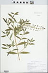
Specimen
Publication Date
7-28-2001
Creative Commons License

This work is licensed under a Creative Commons Attribution-Noncommercial-Share Alike 3.0 License.
Occurrence ID (GUID)
c3b0301c-7582-49e9-a521-b8dd0e90fadc
Barcode Number
EIU013864
Other ID Number
64700
Kingdom
Plantae
Phylum
Magnoliophyta
Order
Ericales
Family
Primulaceae
Genus
Lysimachia
Specific Epithet
terrestris
Recorded By
Zebryk, Tad M.
Record Number
7415
Event Date
2001-07-28
Habitat
marshy shore of beaver pond.
Attributes
Common herb
Cultivated
No
Country
USA
State/Province
Connecticut
County
Tolland
Locality
Marshy shore of beaver pond. Stafford: Hampden Road, 1/2 mile S of state line. USGS Monson Quadrangle. Elevation about 480 feet.
Decimal Latitude
42.023611
Decimal Longitude
-72.320278
Verbatim Coordinates
42°01'25"N 72°19'13"W
Min. Elevation in Meters
146
Verbatim Elevation
Elevation about 480 feet.
Duplicate Quantity
1